CBS News Live
CBS News Los Angeles: Local News, Weather & More
Watch CBS News
Breaking Local News, Weather & Investigations
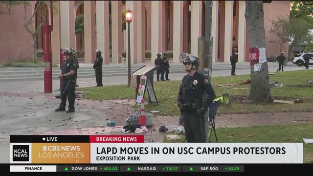
Live images from the campus of USC showed LAPD officers creating a perimeter around the site of the encampment, with no visible protesters on-site. Tents and debris were left behind.
An investigation was underway following a shooting in Long Beach where seven people were wounded.
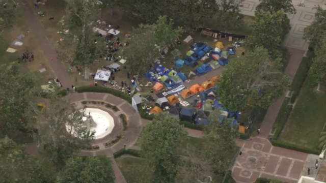
Even as graduation events near at schools like UCLA and USC, protester camps remain on campus after nearly a week of demonstrations.
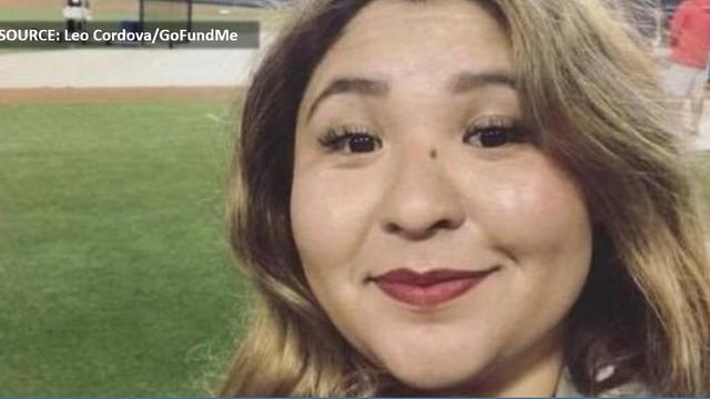
Family members of Mely Corado, the assistant manager at a Silver Lake Trader Joe's that was shot and killed by police in 2018, has reached a tentative settlement in a lawsuit filed with the city of Los Angeles.
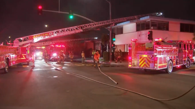
The firefighters who were displaced after a massive fire severely damaged their station in Huntington Park have been relocated, according to Los Angeles County officials.
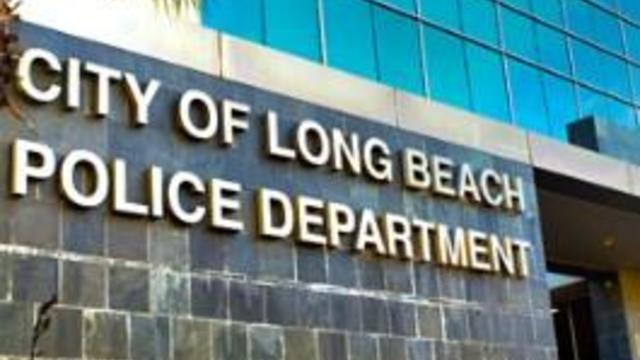
The crash happened at around 6:20 a.m. near the intersection of Ximeno Avenue and Shaw Street, according to Long Beach Police Department officers.
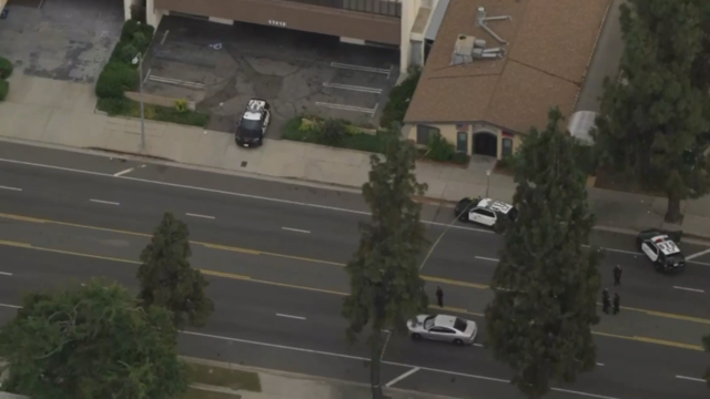
The shooting happened a little after 4:05 p.m. in the 17400 block of Chatsworth Street, according to Los Angeles Police Department investigators.
The driver was ejected from the vehicle due to the force of the crash. A passenger was hospitalized in unknown condition.
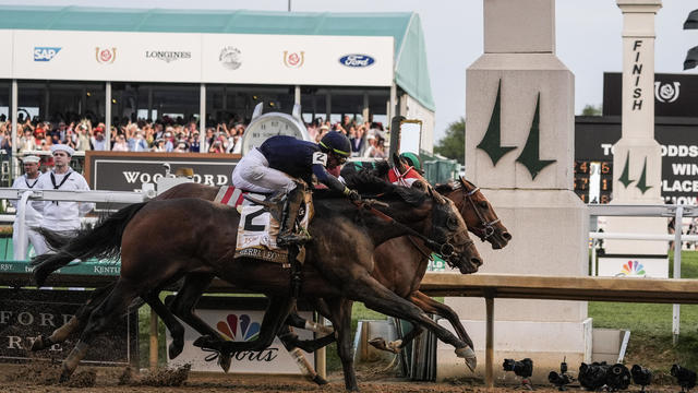
It was just the 10th Kentucky Derby decided by a nose, and the first since Grindstone wore the garland of red roses in 1996.
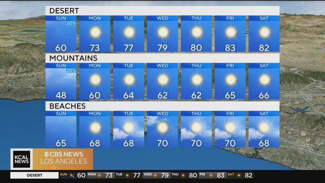
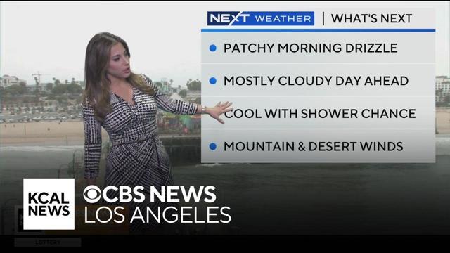
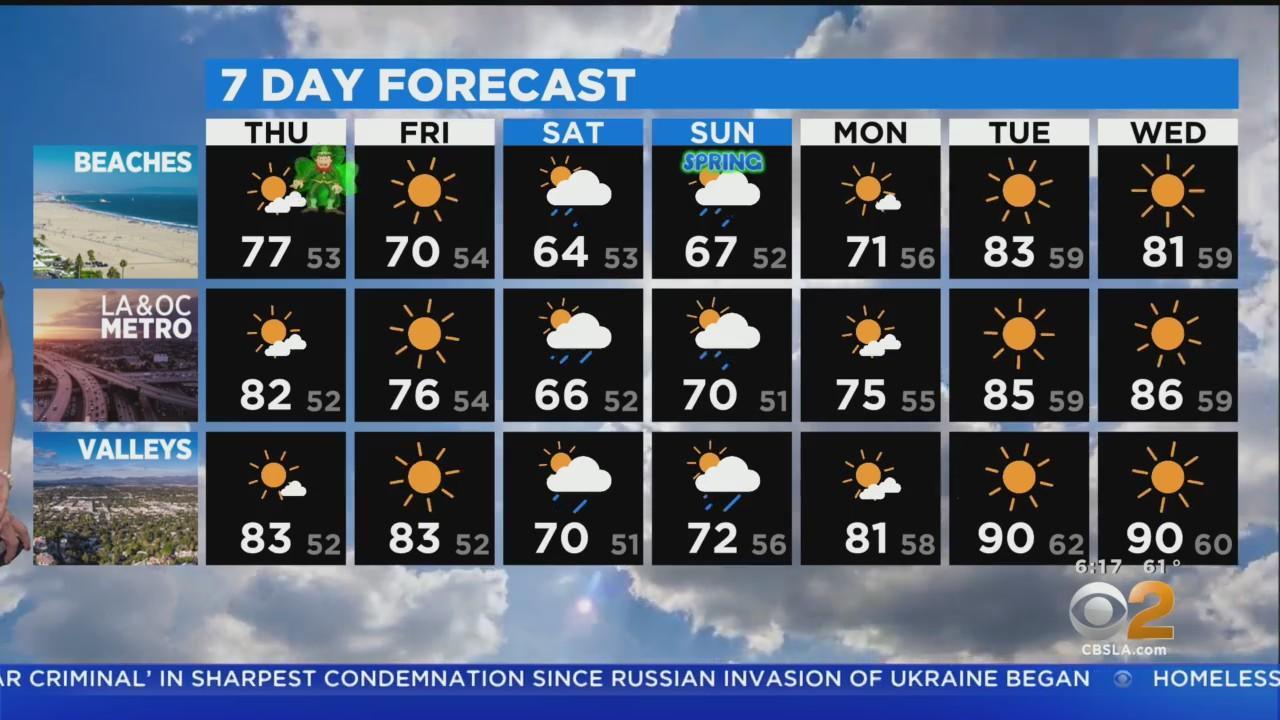
Partly cloudy conditions and light showers are expected Sunday. Alex Biston reports.
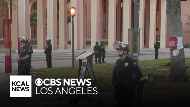
The LAPD moved into the site around 4 a.m., giving a dispersal warning to have protesters clear the area willingly. Rachel Kim reports.
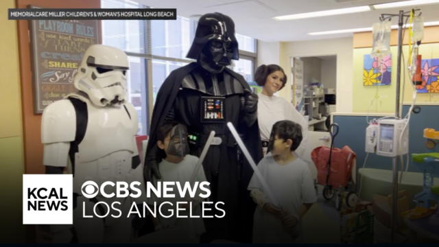
May the 4th be with you! Some young patients at the Miller Children's & Women's Hospital in Long Beach were visited by some travelers from a galaxy far, far away on Star Wars Day.
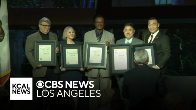
More than two dozen Los Angeles Police Department reserve officers were honored during a ceremony in Brentwood on Saturday.
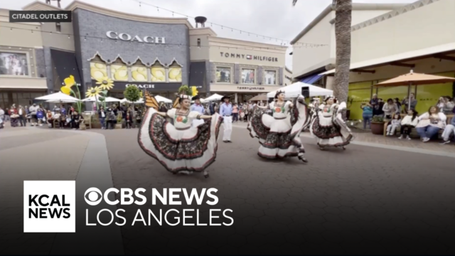
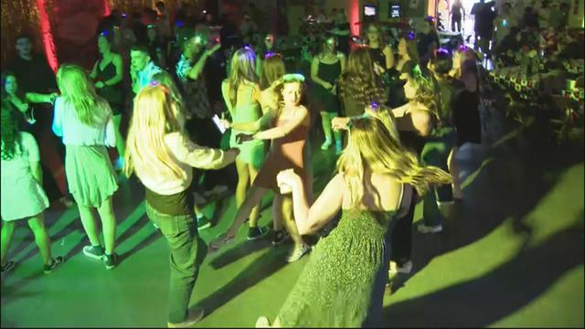
Cinco de Mayo festivities got off to an early start at the Citadel Outlets on Saturday.
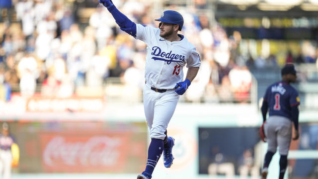
Max Muncy had the first three home run game of his career along with four RBIs, Shohei Ohtani had three hits and became the franchise leader for most home runs by a Japanese-born player and the Los Angeles Dodgers rolled to an 11-2 victory over the Atlanta Braves.
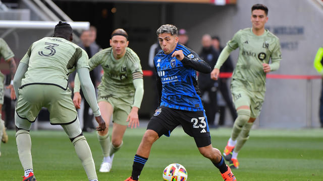
Rodrigues gave San Jose the lead in the 5th minute and the Earthquakes never looked back in a 3-1 victory over Los Angeles FC at Levi's Stadium.
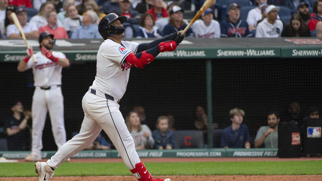
Bo Naylor hit his first career grand slam, Austin Hedges had his first homer since June 14 and the Cleveland Guardians beat the Los Angeles Angels 7-1 on Saturday night.
It was just the 10th Kentucky Derby decided by a nose, and the first since Grindstone wore the garland of red roses in 1996.

Morris played high school basketball at Windward School before attending the University of Michigan. He played was drafted 41st overall by the Lakers in 2011.
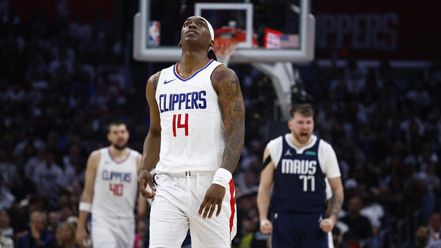
Luka Doncic had 28 points and 13 assists, Kyrie Irving scored 28 of 30 points in a second-half surge and the Dallas Mavericks advanced to the second round of the playoffs with a 114-101 victory over the Los Angeles Clippers.

Los Angeles Angels star Mike Trout will have surgery to repair a torn meniscus in his left knee, sidelining the three-time AL MVP indefinitely.
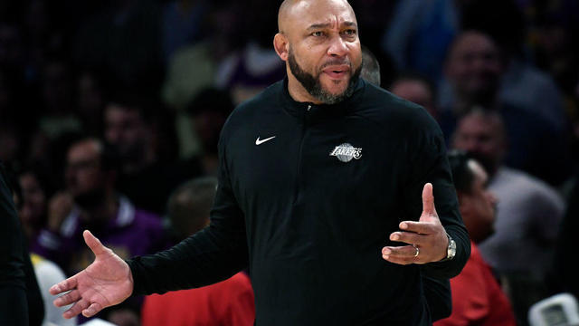
The Los Angeles Lakers have fired coach Darvin Ham, days after the team was eliminated from the playoffs by the Denver Nuggets.
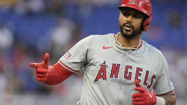
Aaron Hicks was released by the Los Angeles Angels on Wednesday after batting .140 in 18 games.
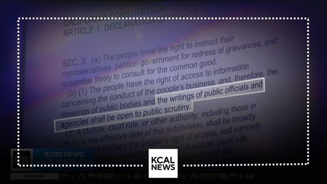
How much crime is there in our schools? How safe are our airports? You have the right to know these things through public records but, as Ross Palombo has found, the state has some serious issues with what they are and are not telling us.
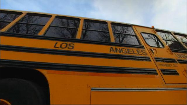
"No teacher should have to lie as part of their job". Ross Palombo talks to a teacher in the Los Angeles Unified School who says he was told to lie about class attendance, which is how the state calculates funding from your tax dollars.
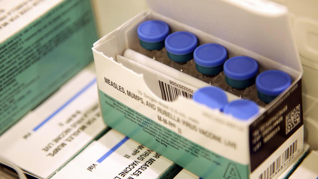
The CDC recommends that at least 95% of students have the MMR vaccine in order to lower the risk of measles outbreaks at their school, but a recent KCAL News investigation shows that hundreds of SoCal schools are well below that number.
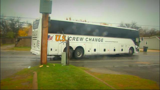
For months, migrants have arrived in Los Angeles on controversial buses chartered from Texas. With a lack of coordination from the Lone Star state, community groups stepped in to help bring things under control and helped hundreds across Southern California.
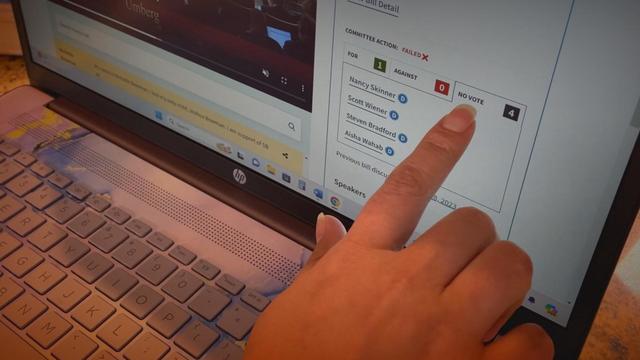
They fought for fentanyl legislation, but it was killed before lawmakers even got to vote. Four grieving moms wanted to know why. They're uncovering the truth using a new AI tool designed to help everyday Californians hold lawmakers accountable. They discovered powerful lawmakers killed the popular fentanyl bill by *not* voting.
The California State Capitol Capitol doesn't generally work the way people think it does. We're following bills prompted by our reporting, to show you how things really work inside California's Capitol.
Watts will raise awareness of serious issues impacting Californians, hold local officials accountable, obtain answers for viewers and provide solutions.
Live images from the campus of USC showed LAPD officers creating a perimeter around the site of the encampment, with no visible protesters on-site. Tents and debris were left behind.
An investigation was underway following a shooting in Long Beach where seven people were wounded.
Even as graduation events near at schools like UCLA and USC, protester camps remain on campus after nearly a week of demonstrations.
Family members of Mely Corado, the assistant manager at a Silver Lake Trader Joe's that was shot and killed by police in 2018, has reached a tentative settlement in a lawsuit filed with the city of Los Angeles.
The firefighters who were displaced after a massive fire severely damaged their station in Huntington Park have been relocated, according to Los Angeles County officials.
An investigation was underway following a shooting in Long Beach where seven people were wounded.
Live images from the campus of USC showed LAPD officers creating a perimeter around the site of the encampment, with no visible protesters on-site. Tents and debris were left behind.
Even as graduation events near at schools like UCLA and USC, protester camps remain on campus after nearly a week of demonstrations.
Family members of Mely Corado, the assistant manager at a Silver Lake Trader Joe's that was shot and killed by police in 2018, has reached a tentative settlement in a lawsuit filed with the city of Los Angeles.
The firefighters who were displaced after a massive fire severely damaged their station in Huntington Park have been relocated, according to Los Angeles County officials.
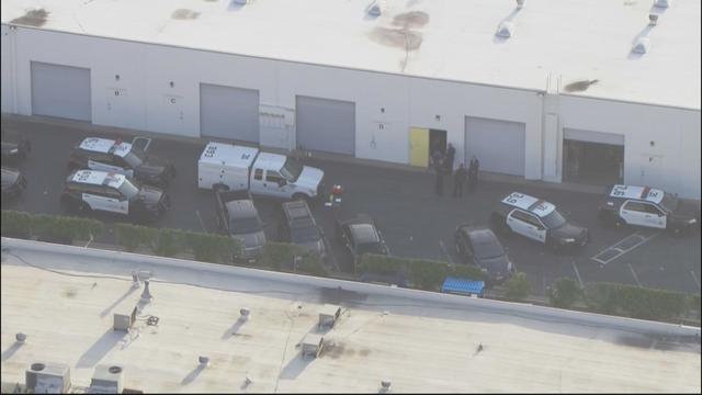
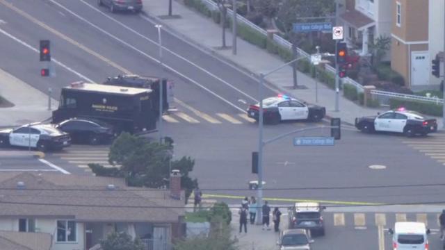
Police discovered two dead bodies inside of a Santa Ana business park.
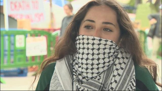
A UC Irvine senior expressed her determination to spread her message despite police arresting more than 200 of her peers at UCLA's pro-Palestinian encampment.
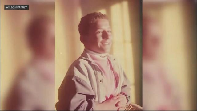
While it was nearly 32 years ago, Micah Stepanian still remembers the beautiful night with his friend Jeff Wilson. That beautiful night ended in tragedy, however, when a teen opened fire on the pair.
Anaheim police said a man who opened fire at an apartment complex killed a woman before ending his own life.
Police say that the incident began as a fight between roommates but escalated into a physical altercation early Sunday.
After the pandemic canceled their eighth-grade dance, a group of high school seniors are getting a party to celebrate the rite of passage they missed out on.
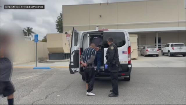
Riverside police arrested 104 people, many of whom identified as homeless, during an undercover operation along the city's Magnolia Avenue corridor.
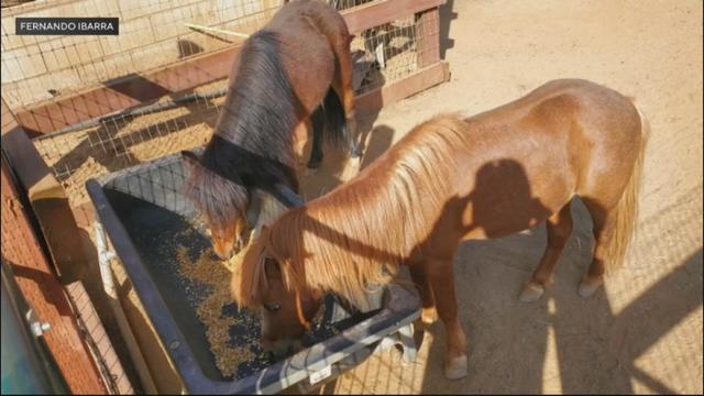
Riverside County resident Fernando Ibarra continues to search for answers after someone shot his beloved pet ponies to death over the weekend.
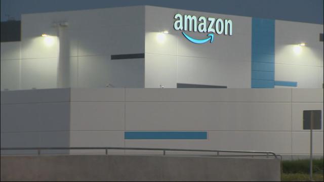
Amazon workers in San Bernardino claim the company will not allow them to take all their state-mandated breaks.
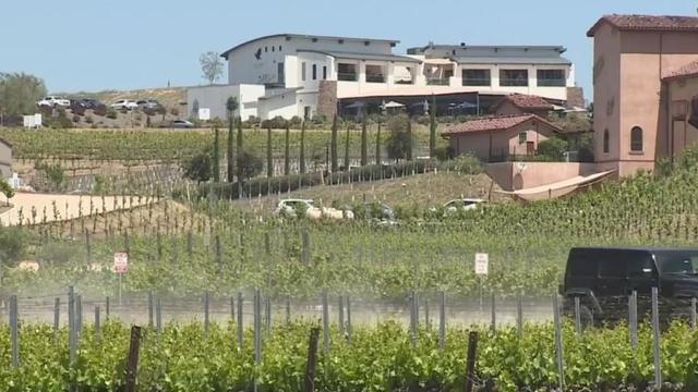
With now 50 wineries, Temecula's vines and wine bring many visitors to the area every year—but it's the small-town charm that keeps them.
"No teacher should have to lie as part of their job". Ross Palombo talks to a teacher in the Los Angeles Unified School who says he was told to lie about class attendance, which is how the state calculates funding from your tax dollars.
The CDC recommends that at least 95% of students have the MMR vaccine in order to lower the risk of measles outbreaks at their school, but a recent KCAL News investigation shows that hundreds of SoCal schools are well below that number.
For months, migrants have arrived in Los Angeles on controversial buses chartered from Texas. With a lack of coordination from the Lone Star state, community groups stepped in to help bring things under control and helped hundreds across Southern California.
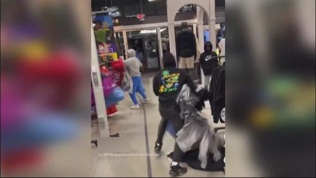
KCAL senior reporter Ross Palombo gets an unprecedented look into the tactics the LAPD uses to stop retail theft.
A federal court ruling involving a controversial arrest within Moreno Valley Unified School District could lead to big changes in school policies nationwide.
It was just the 10th Kentucky Derby decided by a nose, and the first since Grindstone wore the garland of red roses in 1996.
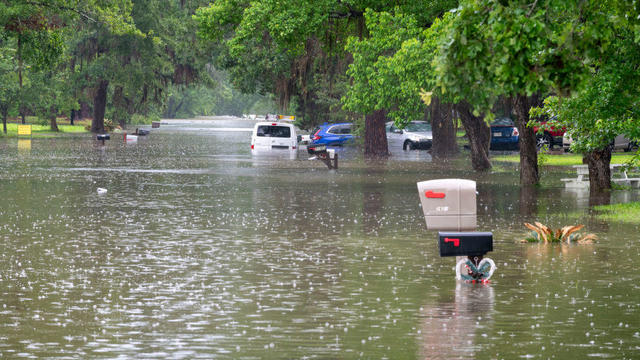
The U.S. Coast Guard said they had medevaced an hours-old baby from Cleveland, Texas, amid the floodwaters.
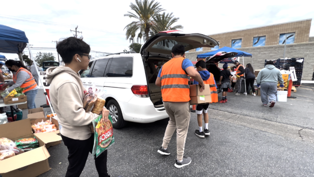
Born in a crucial time of need at the start of the pandemic, this organization began with a scrappy operation. Four million meals later, the Seva Collective has continued to grow.

Job site Indeed identified the top 10 most sought-after job candidates by employers and recruiters. Here's what they found.
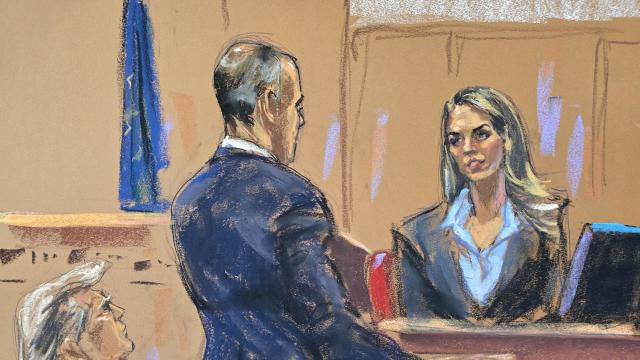
Hope Hicks, one of former President Donald Trump's closest aides for years, told jurors how she handled the fallout from "hush money" payments made to two women before the 2016 election.
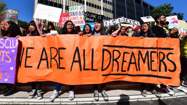
Roughly 100,000 immigrants who were brought to the U.S. as children are expected to enroll in the Affordable Care Act's health insurance next year under a new administration rule, the White House says.
Hope Hicks, one of former President Donald Trump's closest aides for years, told jurors how she handled the fallout from "hush money" payments made to two women before the 2016 election.
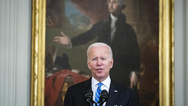
President Biden awarded the Presidential Medal of Freedom, the nation's highest civilian honor, to 19 recipients.

Joshua Dean was a quality inspector at Spirit AeroSystems, which builds the bulk of the 737 Max for Boeing, and recently died from a fast-spreading infection.
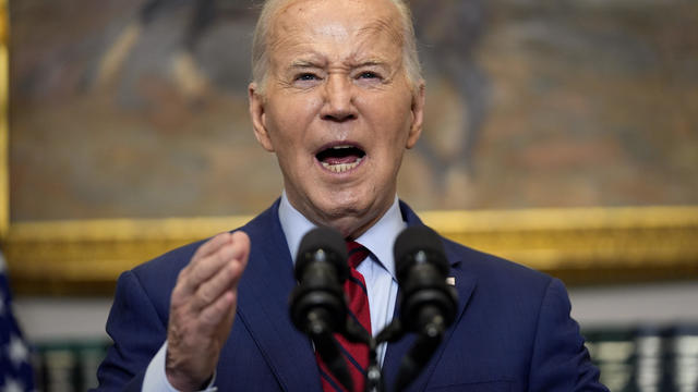
President Biden said "no," the National Guard should not intervene in the protests.
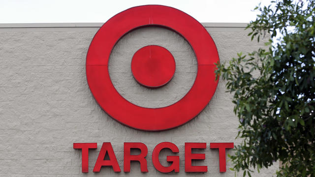
Target, looking for ways to add sales, is relaunching its Target Circle loyalty program including a new paid membership with unlimited free same-day delivery in as little as an hour for orders over $35.
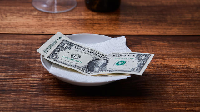
When, who and how much to tip is becoming more of a question in consumers' minds.
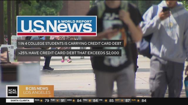
One in four college students says they have credit card debt, according to a new survey by U.S. News and World Report. And with interest rates topping 20 percent, those students could be in debt for years. On Your Side's Kristine Lazar has more on the biggest mistakes college students are making with their credit cards.
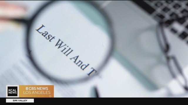
Fewer than a third of Americans have a will. Experts say that could lead to confusion and money loss when someone dies without one. On Your Side's Kristine Lazar has expert tips on who needs a will and how to create one.

Choosing random numbers increases your chances of not having to split the prize money should you win.
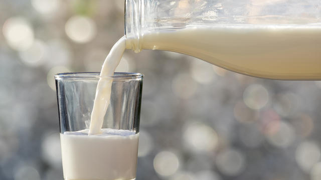
Around 1 in 5 retail milk samples had tested positive for the bird flu virus, but further tests show it was not infectious.
The California State Capitol Capitol doesn't generally work the way people think it does. We're following bills prompted by our reporting, to show you how things really work inside California's Capitol.
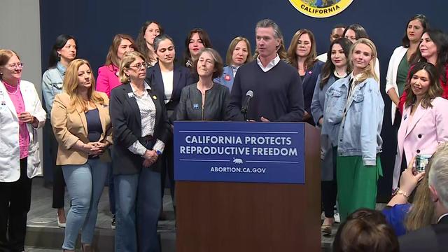
Governor Gavin Newsom is seeking a bold new step to open California medical facilities to Arizona doctors for abortions on their patients after the state's Supreme Court upheld an 1864 abortion ban.
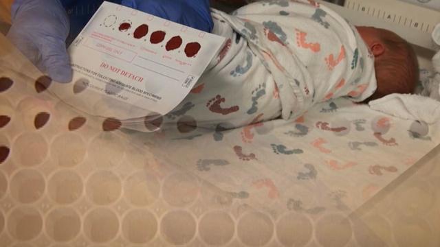
California law says genetic testing companies have to get your permission before they store, use or sell your DNA, but the state itself doesn't have to get your permission and has been storing DNA samples from every baby born there since the '80s. Lawmakers want to change that, but face an uphill battle.
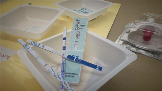
Fentanyl test strips used to be illegal in California. Now, state law requires them on community and state college campuses and they're popping up everywhere from vending machines to bars. They're intended to help young people avoid fentanyl-laced counterfeit prescription pills and tainted recreational drugs. But as fentanyl test strips are normalized – from high school to college to bachelor parties – experts warn test strips alone can provide a false sense of security, and in some cases do more harm than good. We put fentanyl test strips to the test, and what we found could save someone you know.

Robotaxis are hitting the streets of Los Angeles.
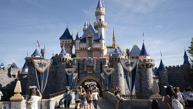
Disney is seeking approval from local officials to expand its California theme park offerings over the next four decades.
Target, looking for ways to add sales, is relaunching its Target Circle loyalty program including a new paid membership with unlimited free same-day delivery in as little as an hour for orders over $35.
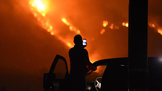
Southern California Edison will pay $80 million to settle claims on behalf of the U.S. Forest Service connected to a massive wildfire that destroyed more than a thousand homes and other structures in 2017.
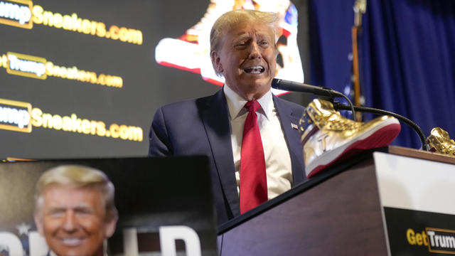
As he closes in on the Republican presidential nomination, former President Donald Trump made a highly unusual stop.
Max Muncy had the first three home run game of his career along with four RBIs, Shohei Ohtani had three hits and became the franchise leader for most home runs by a Japanese-born player and the Los Angeles Dodgers rolled to an 11-2 victory over the Atlanta Braves.
Rodrigues gave San Jose the lead in the 5th minute and the Earthquakes never looked back in a 3-1 victory over Los Angeles FC at Levi's Stadium.
Bo Naylor hit his first career grand slam, Austin Hedges had his first homer since June 14 and the Cleveland Guardians beat the Los Angeles Angels 7-1 on Saturday night.
It was just the 10th Kentucky Derby decided by a nose, and the first since Grindstone wore the garland of red roses in 1996.
Morris played high school basketball at Windward School before attending the University of Michigan. He played was drafted 41st overall by the Lakers in 2011.
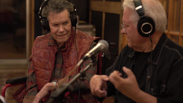
"Sunday Morning" has an exclusive behind-the-scenes look at the creation of the country singer's first post-stroke song, "Where That Came From," which blends art with artificial intelligence in a recording that captures Travis' country heart.
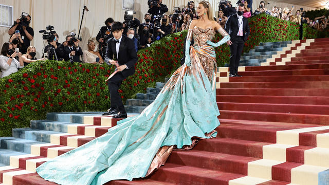
The 2024 Met Gala theme is "The Garden of Time" — to go along with the spring exhibition, titled "Sleeping Beauties: Reawakening Fashion."
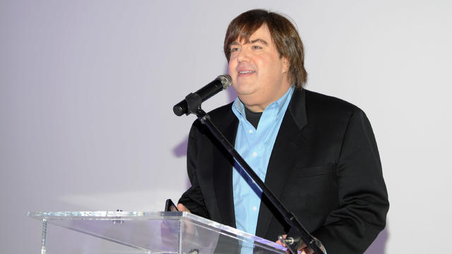
Former Nickelodeon producer Dan Schneider is suing the makers of the documentary "Quiet on Set: The Dark Side of Kids TV" for implying that he sexually abused children.
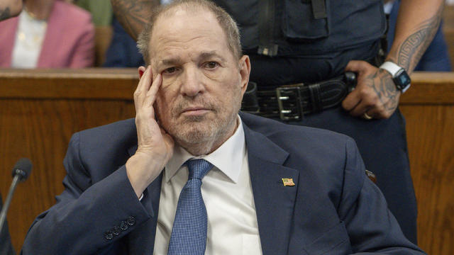
Prosecutors asked for a September retrial for Harvey Weinstein.

See who's nominated for the 77th annual Tony Awards. The Tonys will air live on CBS and Paramount+ on Sunday, June 16.
Partly cloudy conditions and light showers are expected Sunday. Alex Biston reports.
The LAPD moved into the site around 4 a.m., giving a dispersal warning to have protesters clear the area willingly. Rachel Kim reports.
May the 4th be with you! Some young patients at the Miller Children's & Women's Hospital in Long Beach were visited by some travelers from a galaxy far, far away on Star Wars Day.
More than two dozen Los Angeles Police Department reserve officers were honored during a ceremony in Brentwood on Saturday.
Cinco de Mayo festivities got off to an early start at the Citadel Outlets on Saturday.
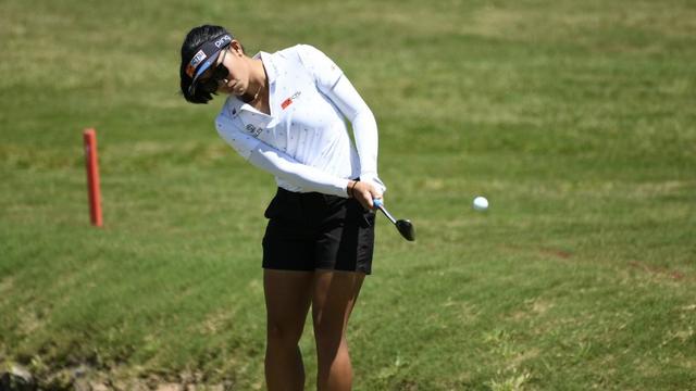
Shots from the second day of the JM Eagle LA Championship held at the Wilshire Country Club in the Palos Verdes Estates.

The Francis Scott Key Bridge in Baltimore collapsed early Tuesday, March 26 after a column was struck by a container ship that reportedly lost power, sending vehicles and people into the Patapsco River.
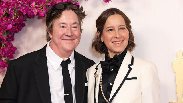
The Academy Awards will hand out filmmaking's top honor in 23 categories during the 2024 Oscars at the Dolby Theatre in Hollywood, starting at 7 p.m. Eastern, 4 p.m. PDT.
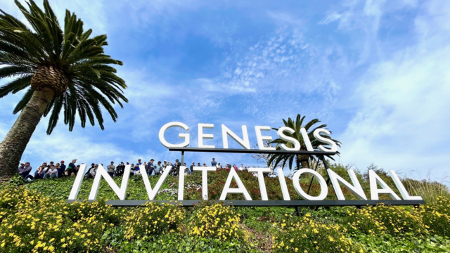
Shots from the PGA's Genesis Invitational golf tournament held at the Riviera Golf Club in the Pacific Palisades.

Even a potentially historic storm bearing down on California couldn't keep the stars away from the red carpet ahead of the 66th Grammy Awards in Los Angeles.